Geomodelling applications
Thanks to the tools and skills developed in the 3D/4D Geomodelling laboratory, several scientific works have been carried out. A few examples of notable and recent applications are detailed below.

Estimation of paleoearthquakes
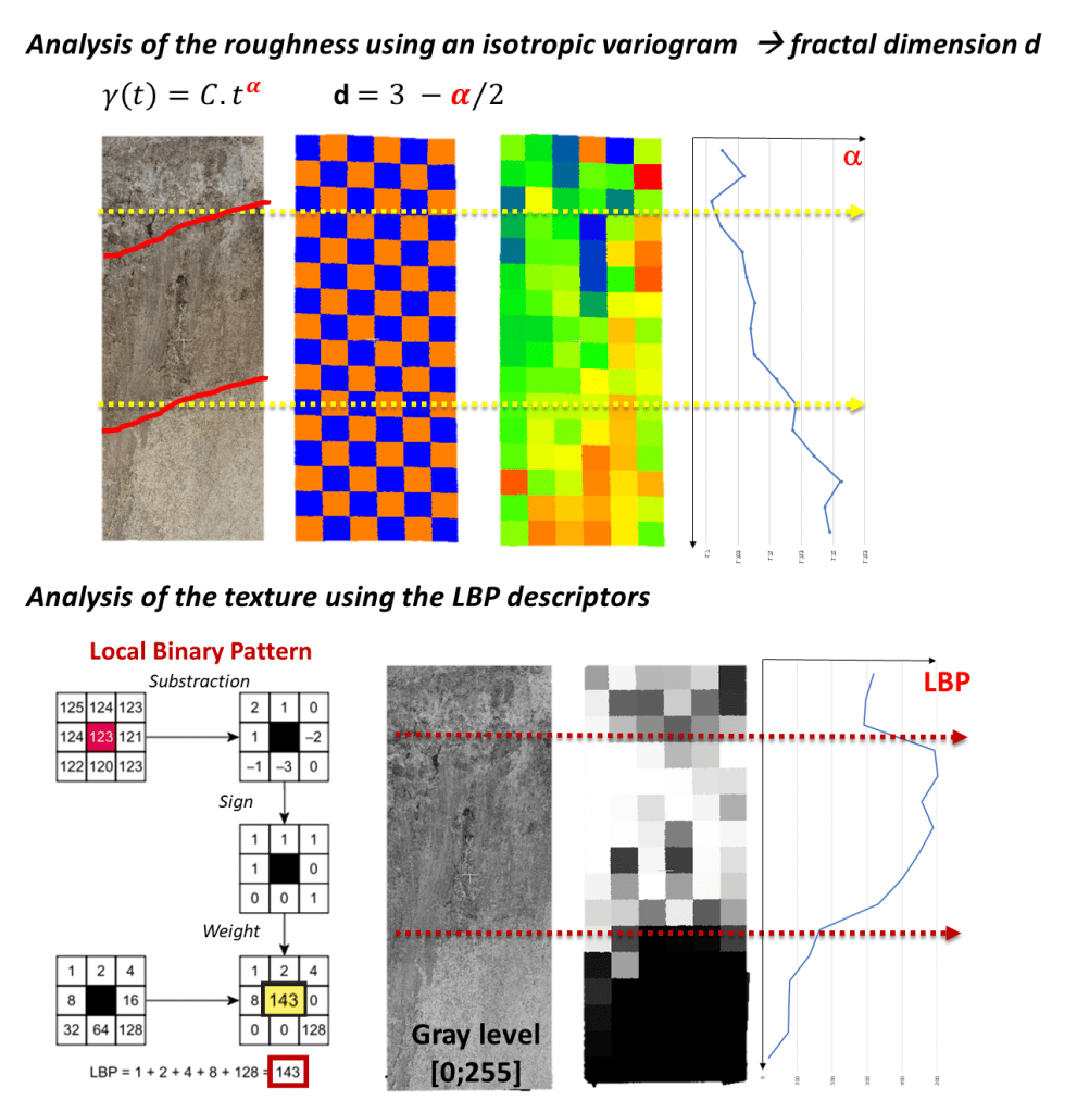
On fault scarps by surface roughness analysis (ANR EQTimeLucilla Benedetti):
Along a fault scarp, it is often difficult to detect with the naked eye the boundary of the palaeo-earthquakes that generated the fault scarp. A module of the CloudCompare software suite has been developed in C++ to automatically map the boundaries of paleoearthquakes along fault scarps in order to better understand their occurrence, by coupling with geochemical data.

Simulation of coccoliths to understand their size controls
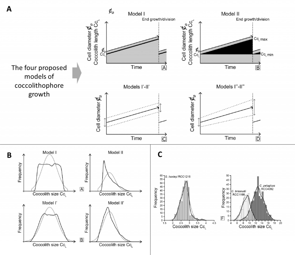
Coccoliths are small platelets generated by a single-celled organism: the coccolithophore. The analysis of these platelets found in sediments makes it possible to estimate certain environmental factors (light, CO2). A stand-alone python code was developed to simulate different scenarios of coccolith production by coccolithophores, in order to better understand the factors that control the size distribution of coccoliths in a population. In addition, analytical solutions of these distributions were found for some of the proposed models.

Innovative method for estimating fracture density
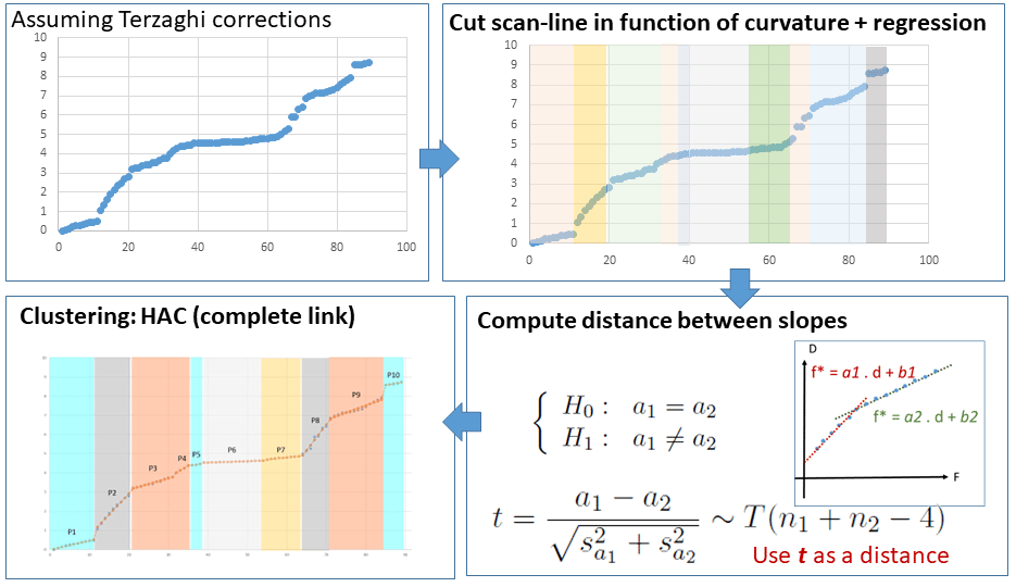
Conventional methods for estimating fracture density along a line (such as a well or scanline) use a sliding window of a certain size. The definition of the resolution of this window affects the result of the fracture density estimates: if the size is large, density variations will not be detected because they are averaged; if the size is small, density variations will be sparse and not significant. It is thus difficult to define an optimal size, especially in the case of strong local variations in fracture density as is the case for fracture corridors. Thus, a method is proposed based on the study of the drift of the cumulative fracture rank curve coupled with hypothesis testing and classification. This method makes it possible to define non-homogeneous zones of fracture density.

Understanding the internal structure of the nucleus of comet Tchury
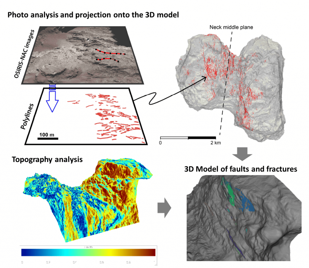
This project is carried out jointly with the LAM (Laurent Jorda, Olivier Groussin) and GeoAzur (Christophe Matonti). High-resolution 3D models have been generated by the LAM from the Rosetta mission photos. These models allow us to analyse the structure of the comet's nucleus in order to explain its bilobed origin and its fate through the play of faults in the comet's neck. A software module (Gocad suite) has been developed to semi-automatically extract fault planes or fractures by topography analysis and coupled with an analysis of fault and fracture traces, to produce a 3D model of the fault network located in the neck of the comet.

